NOAA is the US National Oceanic and Atmospheric Administration . They currently have three satellites in orbit which regularly pass over Europe: NOAA 15, NOAA 18, NOAA 19. They basically continiuously stream pictures back to earth using APT - Automatic Picture Transmission .
Reception
The data transmitted by the satellites can easily be received using your favourite flavour of RTL-SDR or other SDR hardware. While writing this I’m using a NooElec NESDR Smart and GQRX .
GQRX Configuration
- Main configuration (Configure I/O devices screen)
- Input rate: 2560000
- Decimation: 32
- Receiver Options:
- Filter width: User (42k) - set by adjust the filter width on screen
- Filter shape: Normal
- Mode: WFM (mono)
- Input Controls
- DC remove on
- IQ balace on
- Rest off
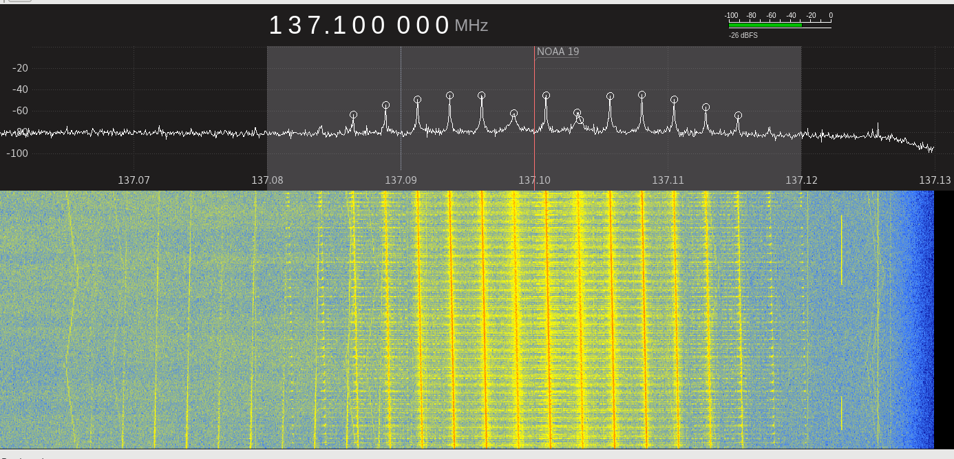
During reception one can perfectly hear the data transmission and watch it in the waterfall plot. Check the Files and Recordings section below for references.
Recording
When the satellite comes into range, simply hit the record button.
Getting the Image
Preparations
Before working with the recording, a bit of prep work using Audacity is necessary. As such open the file and perform the following steps:
- Tracks -> Stereo Track to Mono
- Effect -> Normalize
- Remove DC offset
- Normalize maximum amplitude to -1.0 dB
- Set “Project Rate (Hz)” to 11025 (bottom left corner of the screen)
- Tracks -> Resample
- New sample rate (Hz) at 11025
- Effect -> Normalize
- Just as before
- File -> Export Audio
- Make sure to use
WAV (Microsoft) signed 16-bit PCM
Save!
Decoding
For decoding the received data I’ve been using
WXtoImg
. You can simply start it from the command line by running WXtoImg -G.
It also uses reference data from
CelesTrak
to create a map overlay over the satellite image itself. Have a look at the “Enhancements” menu for all the different options.
Done :)
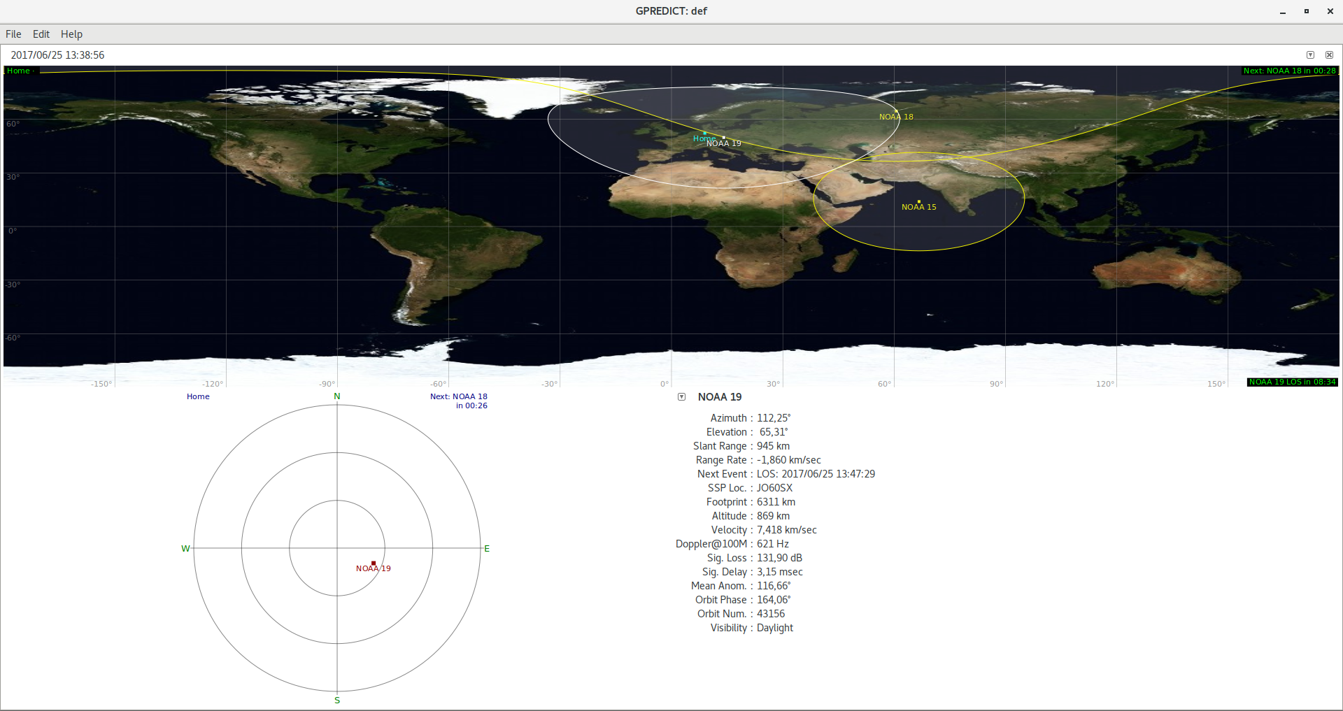
Tracking Satellites
Reception of data is only possible, when the groundstation has line of sight with the satellite, as such you will want to do some tracking. The easiest approach seems to be using GPREDICT which can be found on github . GPREDICT will fetch satellite orbits from CelesTrak and visualizes them on a map. It will also predict time frames in which programmed groundstations are in line of site.
Configuration
- Edit -> Preferences -> General -> Ground Stations : Configure where you have your antenna. Google Maps will probably be the easiest way to find out the proper coordinates.
- Click the little downwards pointing arrow in the top right corner above the map -> Configure : Select the satellites you’d like to track.
Antenna
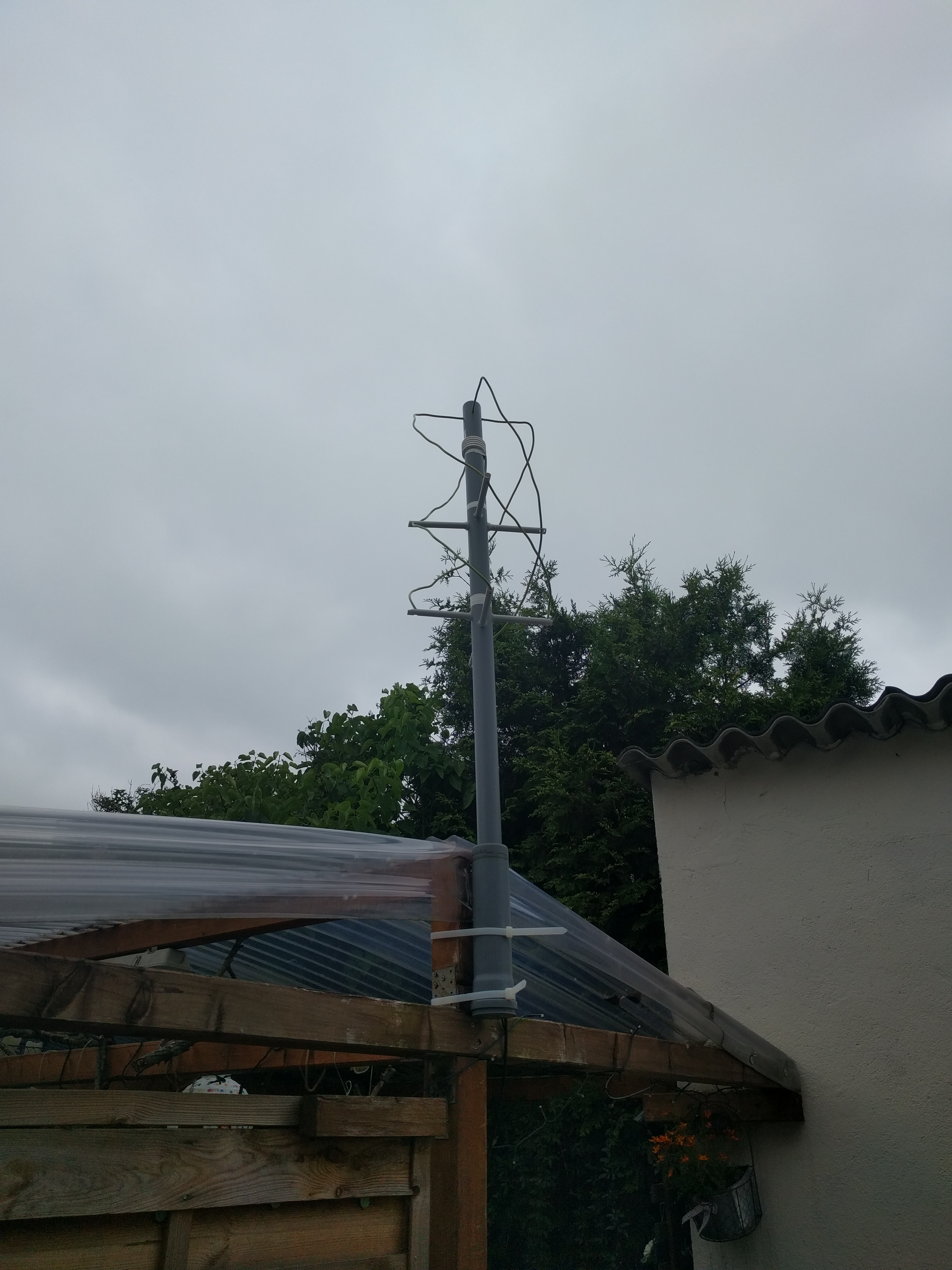
After doing a bit of reading decided to give building a Quadrifilar Helix (QFH) Antenna a try.
I used a 40mm pipe for the center rod and 16mm cable duct for the “arms”. The actual conductor is 10mm² solid core wire (Erdungsleitung). Building the antenna was rather straight forward:
- Enter values into calculator
- Cut and drill pipes
- Put pipes together
- Cut the two pieces of wire
- Insert wire
- Mark the center
- Mark lower 90° bend
- Push through the lowest arm
- Bend upwards
- Push through the center arms
- Mark the necessary length of wire for top arm
- Bend to the side
- Add 45°..60° degree bend to last few cm
- Insert into center pipe
- Do the soldering in the center and attach feed wire
- Use feed wire to wrap the balun
- 4 loops
n. Days of fiddling with the wires and trying to get them into shape
Antenna Positioning
Before setting up the antenna in the attic I gave it multiple test runs in the garden at rather low elevation. One side was partially covered by the mountain range the house is one, one by the house itself, the third partially by our neighbours house. All in all resulting in a rather s***ty place to put an antenna.
After a few days I shifted the antenna into the attic, ~4th floor. While the time frames in which I received data from the satellites rose significantly, the overall signal quality dropped. As expected the tiling is a good shield, especially when it’s wet (rain reduces reception to zero).
Reference
- QFH antenna for the weather satellite band at G4ILO’s Shack
- Helical Quad Antenna for Weather Satellites at alternate.us
- QFH antenna calculator at jcoppens.com
Files, Images and Recordings
The first one ever - NOAA 19, 20170624-1545
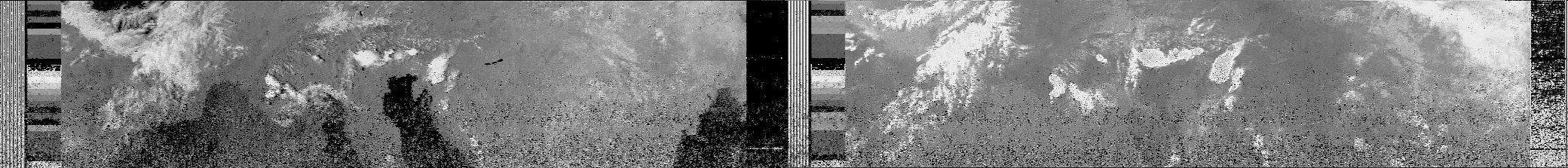
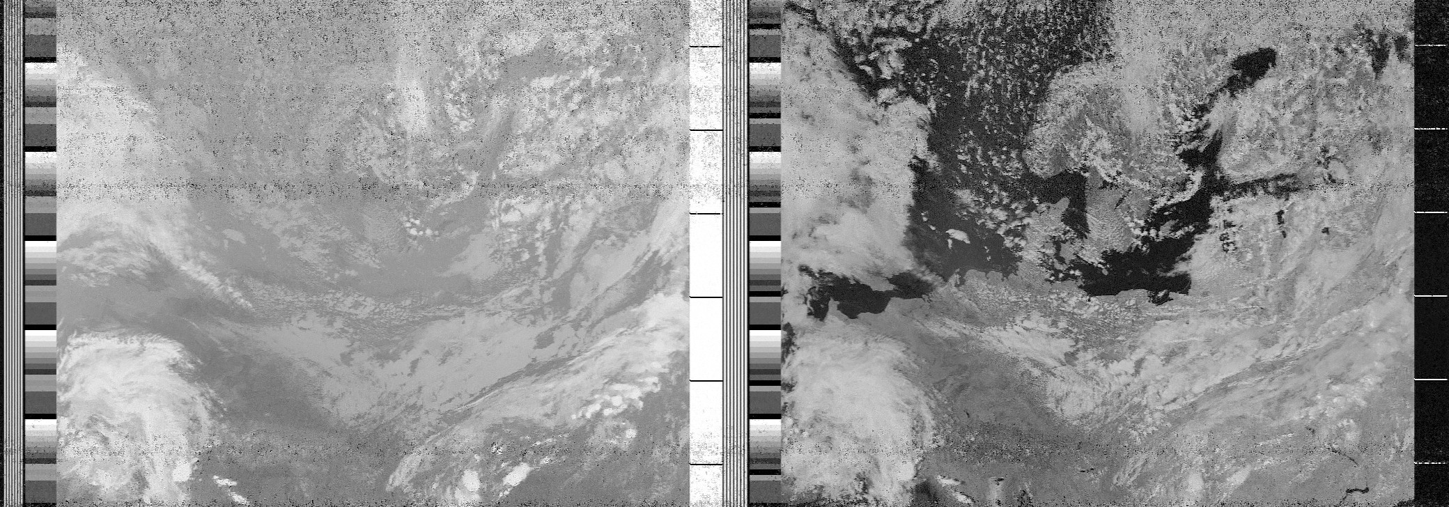
NOAA 19, 2017625-1530
Channel A
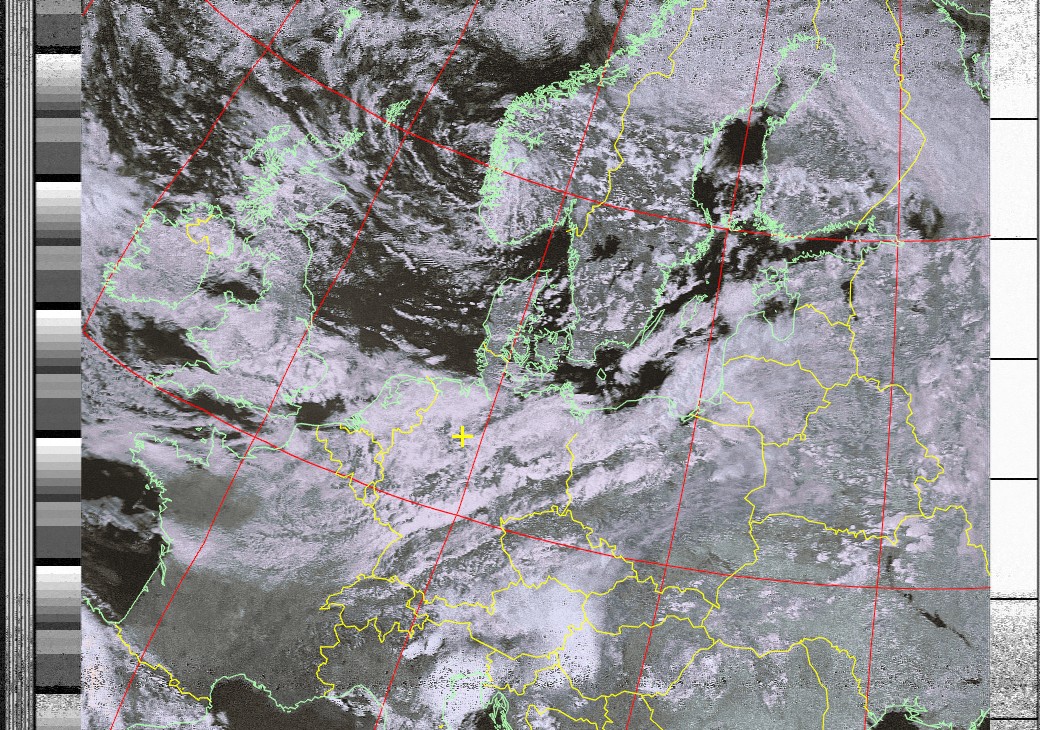
HVC
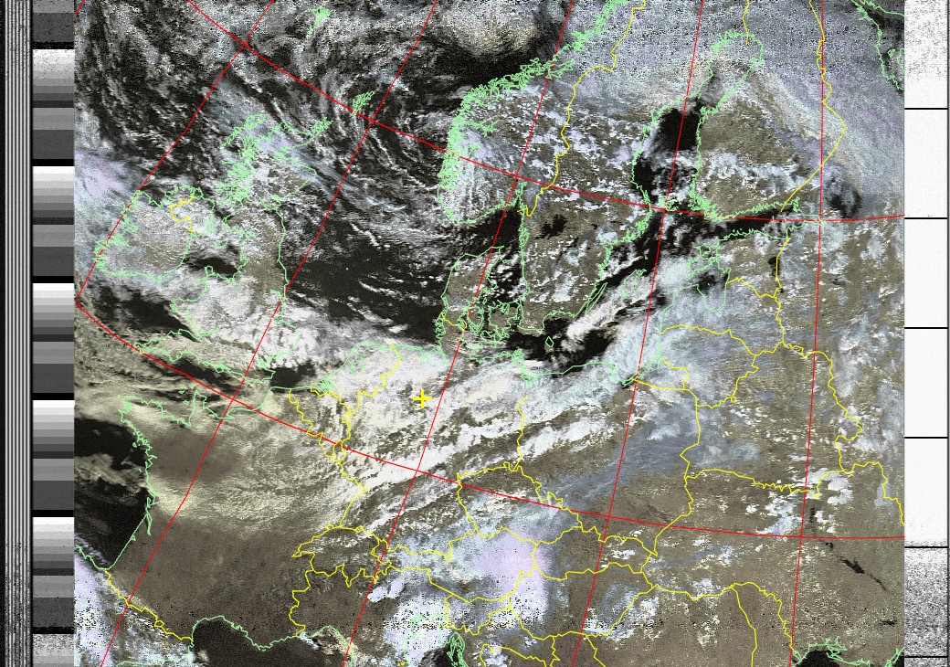
HVCT
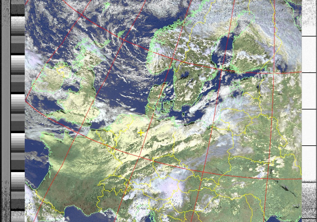
MSA
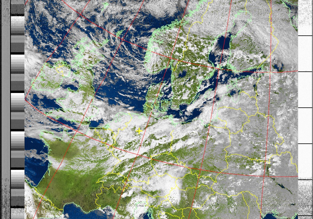
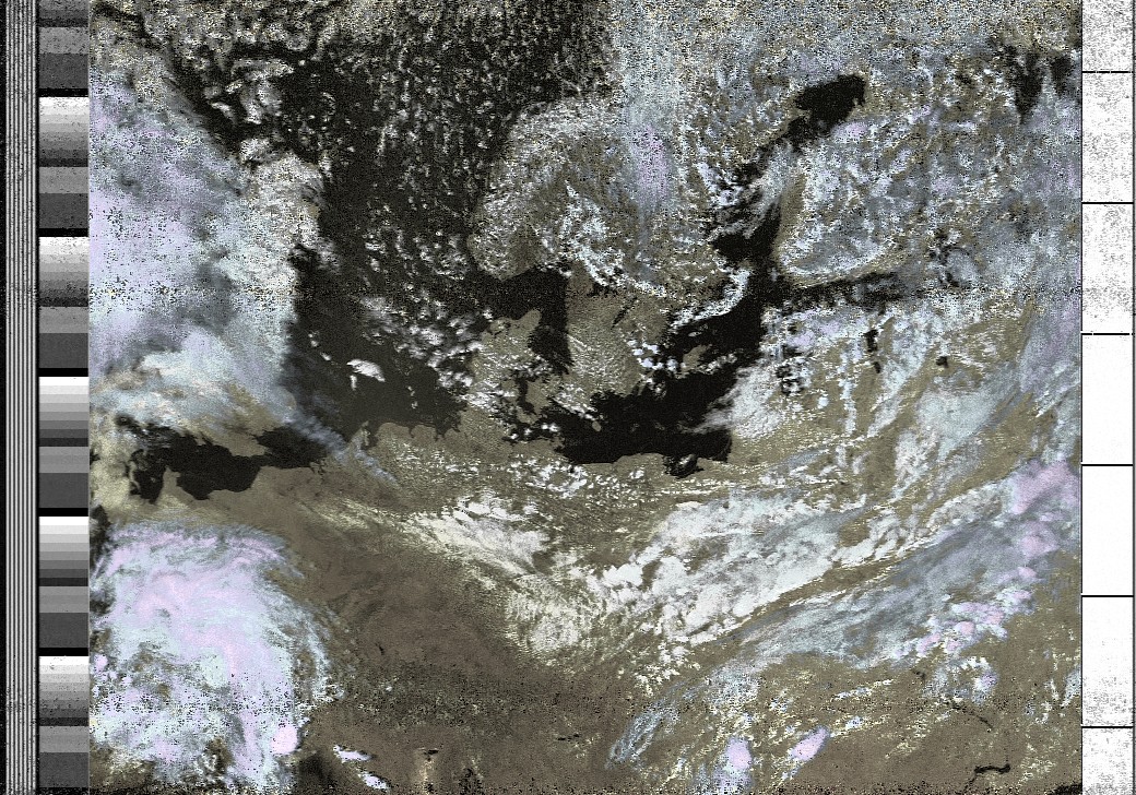
NOAA 19, 20170626-1525
HVC
Raw
Satellites
| Satellite | Frequency |
|---|---|
| NOAA-15 | 137.62 MHz |
| NOAA-18 | 137.9125 MHz |
| NOAA-19 | 137.1000 MHz |
Issues
Antenna and Reception
- Depending on the exact location of your antenna you might and will have certain reception issues.
- I’m located on the side of a mountain-range as such my reception towards the south is really bad.
- Having the antenna in the attic, under the roof, results in bad noise when its raining
WXtoImg
WXtoImg seems to be a really piece of software for working with the received images. While development has been stopped the pro version has been made free. The license key on the webpage will seemingly “not work” as it’s limited for use in 2016. As such there are various workarounds which are based on setting the system time to 2016, starting WXtoImg and changing the year back to 2017. Still the free version seems sufficient.
Also WXtoIMG often does not recognize the satellite pass the image comes from. So far I have not found a proper solution for this problem.